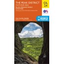
No. OL 1 - The Peak District - Dark Peak area 1:25.000
Ordnance Survey - Wanderkarte (Großbritannien: England Derbyshire)
Series: OS Explorer Map (Sheet No. OL1)
The Peak District
Dark Peak area
Kinder Scout, Bleaklow, Black Hill
& Ladybower Reservoir
(Showing part of the National Park and Pennine Way)
- Scale 1 : 25 000
- gefaltete Karte
Jacket Copy:
Whether you are taking your dog for a walk, your horse for a trot or your family for a bike ride, an OS Explorer Map is the ideal companion to help keep your outdoor activities on track. The detailed scale of 1:25.000 (4 cm to 1 km) means that bridleways, cycle trails and paths are clearly shown, including public rights of way in England and Wales.
These maps also show:
- Picnic areas and viewpoints
- Selected places of interest
- Rights of way information for England and Wales
- National Trail and Recreational Path routes shown
- Selected Tourist information
- doublesided