ITMB International Travel Maps - Straßenkarte (Kanada)
Serie: Travel Reference Map
Yukon
& British Columbia North
- Maßstab 1 : 1 400 000 / 1 : 1 000 000
- gefaltete Karte (doppelseitig)
- Sprachausgabe: Englisch
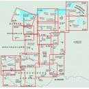
Description by ITMB: This detailed map of the Yukon shows all roads and attractions, campsites, hotel/motels and Protected areas for the Yukon Territory of Canada. It also extends into the Northwest Territory to show the Dempster Highway leading north to Tuktoyaktuk on the Arctic Ocean, and has three inset maps: Whitehorse, Dawson City, and Watson Lake. The reverse side of the sheet has a map of northern British Columbia, showing the Alaska Highway, the more westerly Stuart Highway, and the highway from Skagway, in Alaska, north into the Yukon. Apart from flying to the territory, these are the only three access points to reach the Yukon except, of course, the two entry points from Alaska that are included on the Yukon side of the sheet. This side is the most detailed map of the most northerly portion of BC ever printed, showing campsites, hiking areas, accommodations, fueling stations, parks, and, most importantly, Liard Hot Springs!
Map size: 27*39"
Legend Includes:
International Boundaries, Provincial Boundaries, Ferry Route, Railway, Motorway, Major Highway, Main Road, Rivers, Mountain Peaks, Historic Site, Camping, Beach, Wildlife, etc.
Ausgabe 2023