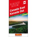
ITMB International Travel Maps - Straßenkarte (Kanada)
Serie: Travel Reference Map
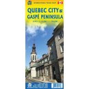
Quebec
Montreal
- Maßstab 1 : 1 620 000 / 1 : 1 150 000
- gefaltete Karte (doppelseitig)
- Sprachausgabe: Englisch
Description by ITMB: The largest geographical province of Canada is Quebec. While much of it is inaccessible landmass, the province is home to millions of people, both French and English, and is a major North American attraction. It contains the only walled city in the continent (Quebec City, the capital), a major ski resort (the Laurentians), and the vibrant city of Mont Real (Montreal). The map is double-sided, with the vast expanse of northern Quebec on one side (count the number of lakes!) and the more populous south on the other side. Due to the size of the province, there was only room left over for a regional map of the Montreal area, but ITMB does publish a separate map of that city for those needing more detail. As a point of trivia, the northernmost tipoff the Labrador Peninsula is part Nunavut, as are all of the islands.
Legend Includes:
Roads by classification, Rivers and Lakes, National Park, Airports, Points of Interests, Highways, Main Roads, Zoos, Fishing, and much more.
Ausgabe 2019